Scene Editor is a modern, intuitive and easy-to-use editing tool aimed at data creation and edition.
It allows rapid creation of detailed scenes with realtime 3D preview, and offers a one-click experience to compile and pack all relevant data in a streaming-friendly data format taylored for an optimal usage by the IG.
Data management made easy
The IG relies on an additive datasets management systems (i.e. user-defined folders are scanned for available datasets at IG startup, found datasets are then automatically merged at runtime). Datasets can be created/edited independantly from each others, significantly simplifying data management for the users.
Editor scenes can be discretized and organized by location, by type, or by any custom criteria.
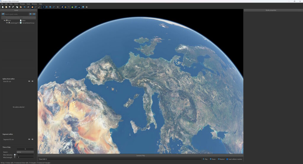
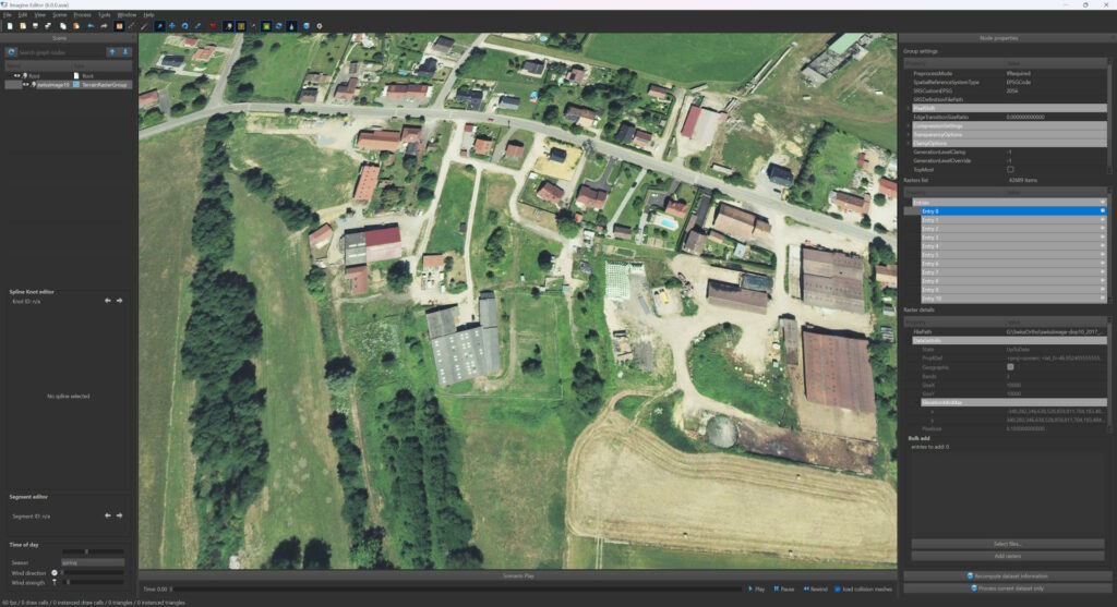
GIS data import
Deeply integrating GIS functionalities (import, reprojection, blending etc.), the editor offers compatibility with most raster formats (satellite & aerial imagery), elevation formats and vector data formats.
Transition can be added at imagery borders for smoother integration of high resolution datasets over base underlying raster/elevation layers.
Raster and elevation datasets reprojection and processing uses all CPU cores. Imagery processing time is incredibly fast since benefiting from all resources available on the system.

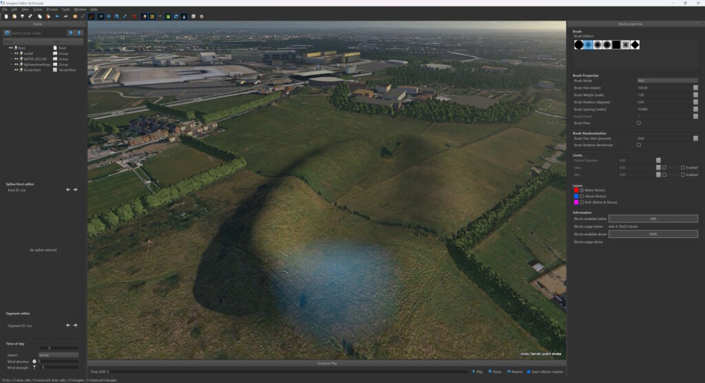
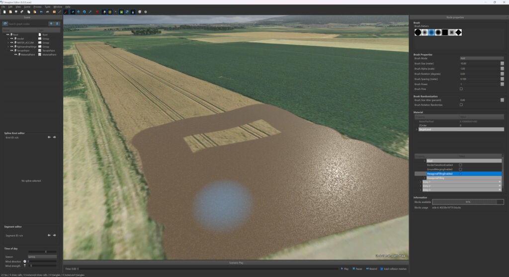
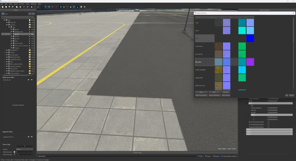
Terrain painting and sculpting
Terrain sculpting is as easy as using MS Paint. Choose your brush shape, size and strength and start sculpting the terrain elevation in realtime.
Terrain can also be painted using various material types (texture, color, etc.) in the exact same manner.
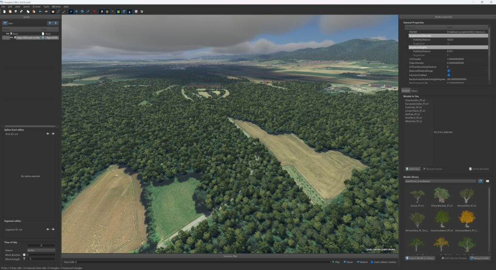
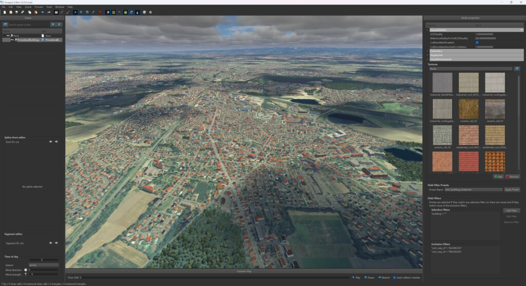
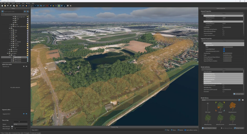
Procedural content
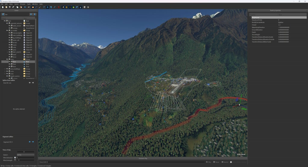
High-quality procedural content generation routines are available, allowing the creation of various elements based on vector data (OSM, etc.) in an extremely quick and easy way.
Country-size areas can be realistically populated in a couple of hours time:
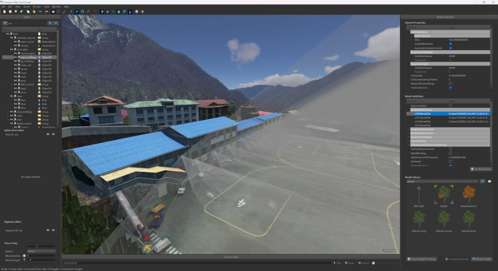
- 3D buildings
Footprints, but also metadata when available (floors number, building type, etc.), are used to produce 3D models with 3 LODs (levels of detail).
Use the wall and door/window texture library, or your own textures. - forests (and single trees)
- lakes and rivers
- roads with streetlights

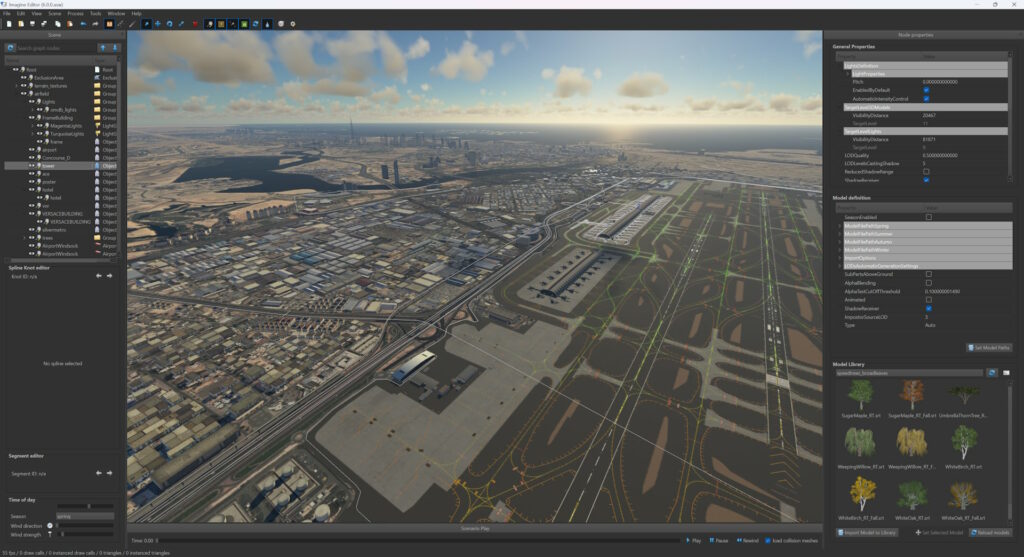
3D models
Custom 3D models can also be imported easily. Thanks to the built-in importers, all common formats are supported (we also offer a custom exporter plugin for 3DS Max). They can be added to the scene as single object, or along a path, or used to fill an area defined by a polygon.
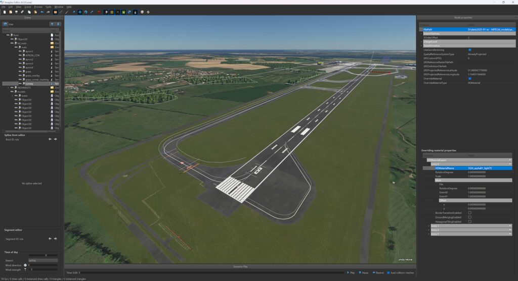
Vector data
Vector data can be imported, or added/edited manually through the editor. Various material types can be applied to customize their look.
Lights
Lights can be defined, either procedurally (OSM data for instance), or manually.
3D models can also be configured to contain lights, in which case lights will be automatically created along with each instance of that 3D model.

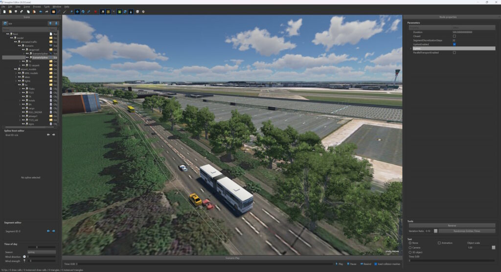
Scenarios
Scenarios can be defined in the editor in order to be played at runtime by the IG.
Simple scenarios can be defined using entities attached to splines (to add some background traffic for instance).
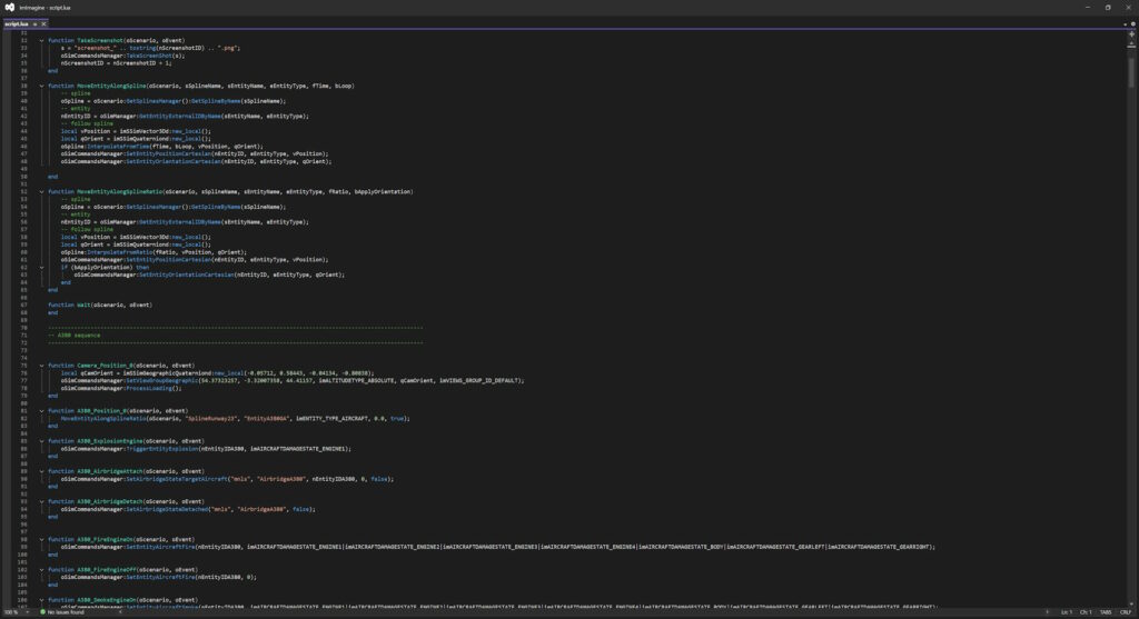
More complex scenarios can use Lua script (all SDK routines are exposed to Lua).